O’Hare Area Bike Network Study
STUDY OVERVIEW
The Cook County Department of Transportation and Highways (DoTH) has initiated a subregional study to evaluate, plan and identify opportunities to create a more connected bikeway network near O’Hare International Airport. This study is one of twelve bike network study areas to fill gaps recommended as part of the 2023 Cook County Bike Plan. A primary study goal is to recommend projects and improvements to increase bicycling safety and connectivity in communities near the airport.
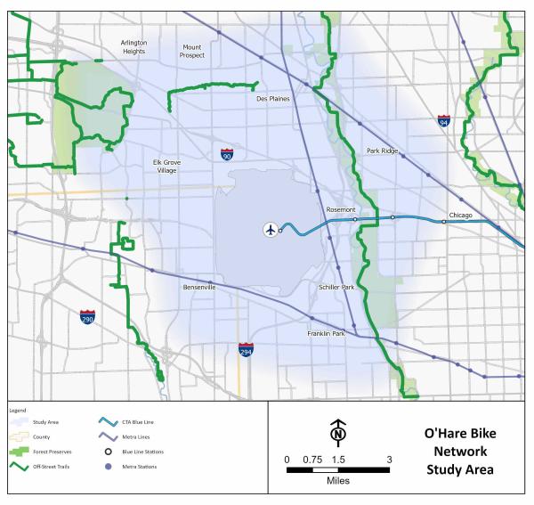
The study area can be seen in the map below. It includes all or parts of Bensenville, Chicago, Des Plaines, Elk Grove Village, Franklin Park, Mount Prospect, Park Ridge, Rosemont and Schiller Park.
This study will focus on a series of recommendations to overcome existing barriers such as interstates, high volume roads, railroads, truck traffic, freight activities and river flood plains that often do not permit biking on certain routes or make it challenging. These recommendations may include on-street bike lanes, off-street trails and shared streets to create a complete bike network that promotes safe, comfortable, accessible, connected and equitable biking opportunities to major community destinations. The study will prioritize various segments based on criteria such as ease of construction, consistency with other planning efforts and availability of funds, and the plan will propose an implementation plan for the next 10 to 15 years.
Survey
The study included a survey to introduce the study’s goals and background to the public as well as to collect initial feedback and input on key transportation challenges, issues and solutions. The survey closed in September 2025.
Virtual Meetings
On December 11, the O'Hare Area Bike Network Study Project Team hosted a virtual public information meeting. The meeting provided an opportunity for community members to learn more about the project, speak with the team and give feedback on potential on-and off-street bicycle facilities and enhancements to existing facilities. You can access the presentation slides and the webinar recording using the links below.
Watch the recording here https://www.youtube.com/watch?v=WbPihu-x-SI
To sign up to receive emailed notifications about the O'Hare Area Bike Network Study, click HERE.
TIMELINE

This study began in winter 2025 with goal and vision setting, data collection and an analysis of the bicycle network. Stakeholder engagement will occur throughout the study and include the following activities:
- Guidance from the Steering Committee, which is made up of representatives from the local communities
- Interviews with key stakeholders
- A public survey
- Bike tours (four total)
- Virtual public meetings (two total)
Network strategies will be developed late in 2025 and will culminate in a final report with prioritization and implementation strategies targeting early 2026.
Email Notifications
To receive email notifications about the O'Hare Area Bike Network Study, click HERE.